Inner Mongolia
Panoramic introduction to Inner Mongolia Autonomous Region
The Inner Mongolia Autonomous Region, abbreviated as "Meng", was established on May 1, 1947, and is the first autonomous region established in China for ethnic minorities. With a total area of 1.183 million square kilometers, accounting for 12.3% of the country's land area, it is the third largest provincial administrative region in China. At the end of 2022, the permanent resident population was 24.01 million, of which the Mongolian population was about 4.5 million. As an important ecological barrier and energy base in northern China, Inner Mongolia's regional GDP reached 2.32 trillion yuan in 2022.
Inner Mongolia currently administers 9 prefecture-level cities and 3 leagues (equivalent to prefecture-level cities), including Hohhot (the capital), Baotou, Wuhai, Chifeng, Tongliao, Erdos, Hulunbeir, Bayannur, Ulanqab, Xing'an League, Xilin Gol League, and Alxa League. The autonomous region spans three major regions: Northeast, North China, and Northwest, bordering eight provinces and regions, as well as Russia and Mongolia, with a borderline of up to 4,200 kilometers.
II. Geographical Features
1. Location characteristics
Inner Mongolia is located between 37°„24°‰ N and 53°„23°‰ N latitude, and 97°„12°‰ E and 126°„04°‰ E longitude. It is elongated and extends from east to west, with a straight-line distance of over 2,400 kilometers from east to west and a span of over 1,700 kilometers from north to south. It borders Heilongjiang, Jilin, and Liaoning to the east, Hebei, Shanxi, Shaanxi, and Ningxia to the south, Gansu to the west, and Russia and Mongolia to the north.
2. Topography and landform
The terrain of the entire region is complex and diverse, exhibiting overall plateau-like landform characteristics:
Eastern region: Daxing'an Mountains
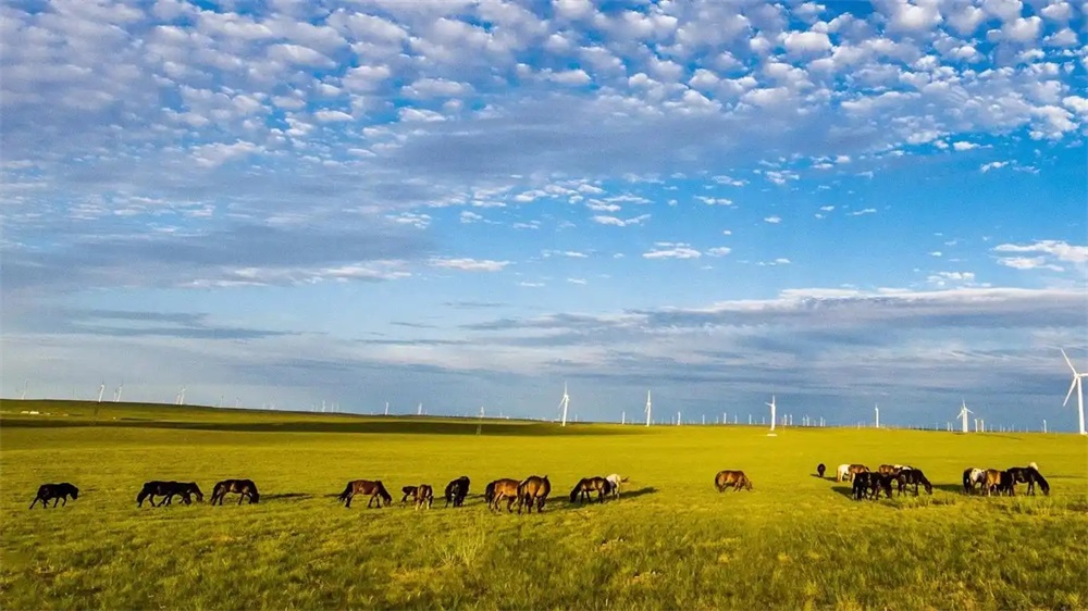
Central region: the Inner Mongolian Plateau (accounting for over 50% of the total area)
West: Alxa Plateau
Hetao Plain: a fertile area along the "J" bend of the Yellow River
3. Water system distribution
Yellow River: flowing through the west and south
Ergun River: the boundary river between China and Russia
Nenjiang River and West Liaohe River: main water systems in the east
Inland river: Xilin Gol League and other places
4. Climate characteristics
It belongs to temperate continental climate:
Annual average temperature: 0-8°Ê
Annual precipitation: 50-450 mm (decreasing from east to west)
Salient features: cold and long winters, warm and short summers, and large temperature differences between day and night
III. Historical Context
1. In ancient times
Paleolithic Age: Hetao Man Site (about 50,000 years ago)
Neolithic Age: Hongshan Culture (about 6000 years ago)
2. Ancient history
Pre-Qin period: regions where nomadic tribes such as the Xiongnu and Donghu lived and conducted activities
During the Qin and Han dynasties: The Southern Huns submitted and counties such as Shuofang were established
During the Northern Wei Dynasty: The Xianbei ethnic group established a political regime
Liao and Jin dynasties: ruled by the Khitan and Jurchen tribes
Yuan Dynasty: officially incorporated into the territory of the central government
3. Modern and contemporary development
During the Qing Dynasty: Special regions such as Suiyuan and Chahar were established
1947: The Inner Mongolia Autonomous Region was established
After the founding of the People's Republic of China: administrative divisions underwent multiple adjustments
21st century: important nodes of the Western Development and the Belt and Road Initiative
IV. Cultural Essence
1. Prairie culture
Nomadic civilization: ecological wisdom for harmonious coexistence with nature
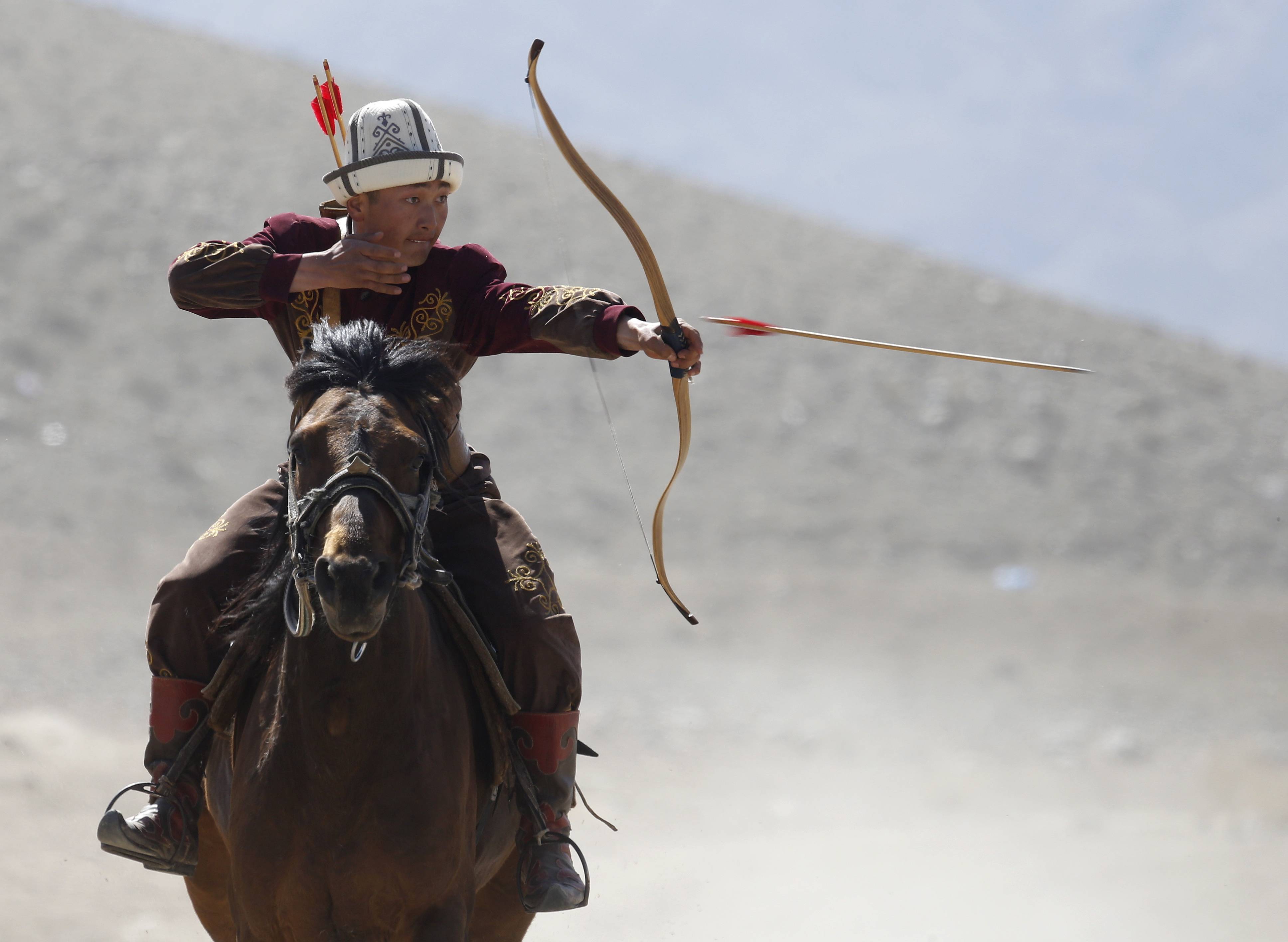
Horseback culture: equestrianism, horse racing, and horse-head string art
Oboo Culture: A Sacred Grassland Site for Sacrifice and Blessing
2. National culture
Daur ethnic group: traditional sport of hockey
Ewenki: Reindeer Culture
Elunqun ethnic group: hunting culture
3. Intangible cultural heritage
Traditional music: long-tune folk songs, throat singing
Traditional dance: Andai dance
Traditional skills: Mongolian clothing making, felt embroidery
Folk customs: Aobao worship, Nadam
4. Language and culture
Mongolian: the common language and script of the autonomous region
Chinese dialects: Jin dialect, Northeastern Mandarin, Beijing Mandarin, etc
Other ethnic minority languages: Daur language, Ewenki language, etc
V. Tourist attractions
1. Natural landscape
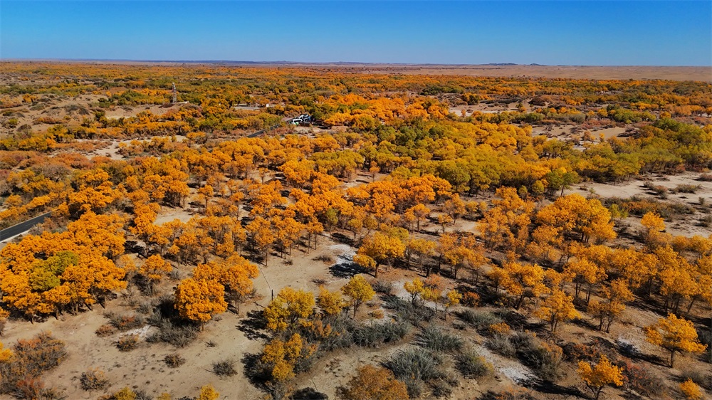
Ejina Poplar Forest: One of the Only Three Poplar Forests Left in the World
Alshan: Volcanic Landform and Forest Landscape
Kubuqi Desert: the seventh largest desert in China
2. Cultural landscape
Genghis Khan Mausoleum: A sacred memorial site for a great leader
The Site of the Yuan Dynasty Shangdu Capital: World Cultural Heritage
Zhaojun Tomb: A Symbol of Ethnic Unity
Wudang Temple: a Tibetan Buddhist temple
3. Special tourism
In-depth grassland tour: staying in a yurt, horse riding and archery
Border Tour: Manzhouli and Erlianhaote Ports
Ice and Snow Experience Tour: Hulunbeir Winter Nadam Fair
Desert adventure tour: Sounding Sand Bay, Moon Lake
VI. Food Map
1. Traditional meat dishes
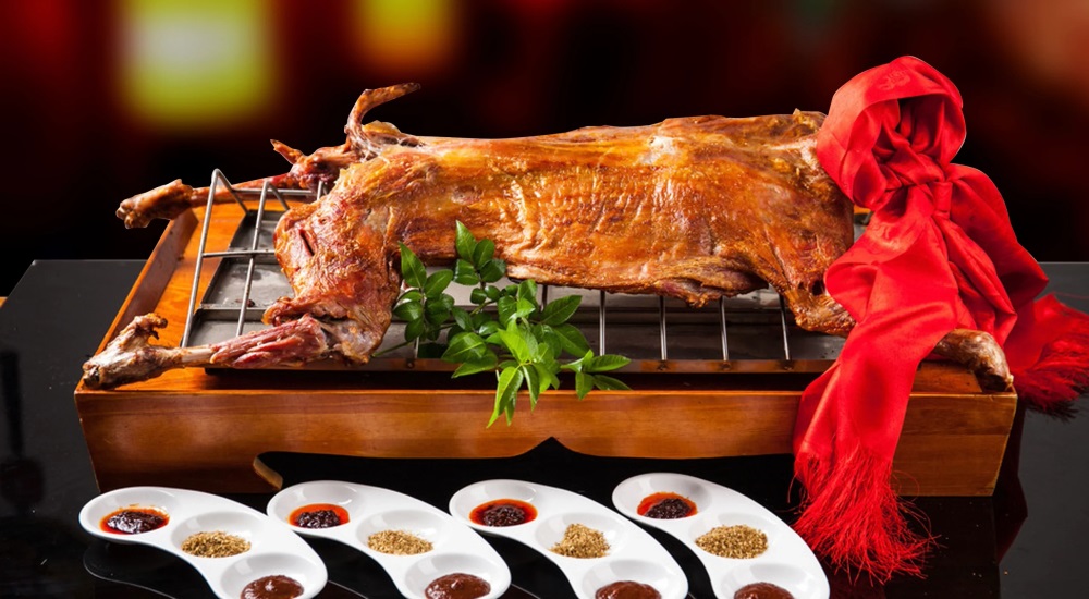
Roasted whole lamb: the highest courtesy for Mongolian people to treat guests
Dried beef: the crystallization of nomadic wisdom
2. Dairy products
Milk tea: a savory and delicious daily beverage
Dairy tofu: a nutritious dairy product
Yogurt: made by traditional fermentation method
3. Specialty staple food
Noodles made from hulled oats: various ways to prepare healthy coarse grains
Mongolian pie: a delicious dish with a thin crust and generous filling
Fried rice: a portable and storable food
4. Local snacks
Shaomai: a specialty breakfast in Hohhot
Blood sausage: a meat product with unique flavor
Napi Zi: concentrated milk essence
VII. Current Development Status
1. Pillar industry
Energy industry: coal, rare earths, natural gas
Agricultural and livestock product processing: dairy industry, meat, and wool
Equipment manufacturing: Baotou Steel, heavy-duty vehicles
Tourism: Grassland characteristic tourism
2. Transportation network
Railway: the east-west thoroughfare of transportation
Highways: The mileage of expressways ranks among the top in the country
Aviation: 13 airports including Hohhot Baita International Airport
Ports: Manzhouli, Erlianhaote, and other windows open to the outside world
3. Ecological construction
Grassland ecological protection: grazing reduction and grassland restoration project
Preventing and controlling sand: A model of desert management in the Kubuqi Desert
Nature reserves: Establish 182 protected areas at all levels
From the vast grasslands to the boundless forests, from the expansive deserts to the fertile river valleys, Inner Mongolia, this magical land, is writing a magnificent chapter in the new era, guided by ecological priority and green development. It is not only a beautiful scenery in the northern border of the motherland, but also a happy home where all ethnic groups support and strive together.
simliy